

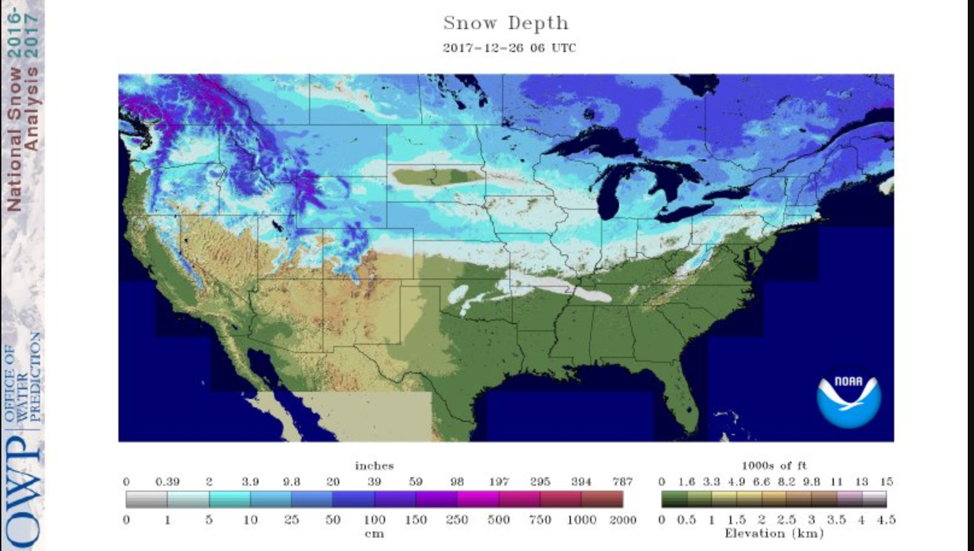
Updated Modeled Snow Depth for the Continental U.S. on 12/26/2017 from NOHRSC.
Santa was nice to us this year! He was especially generous in the east and west. Our overall snow depth totals have increased just about everywhere. The only exception is one spot in the north half of South Dakota that is snow free.
Across the west, low elevation areas now have anywhere from 2 to 10 inches. Higher elevations have also increased their snow depths. As snow depths increase in higher elevation, always beware of avalanche prone areas.
The Midwest also received snow over the weekend. Snow belts in Northern Michigan and the UP received plenty of lake effect snow that is still ongoing in many locations.
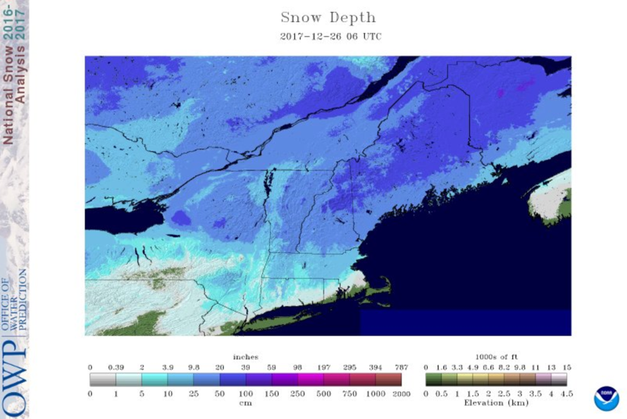
Updated Modeled Snow Depth for the Northeast on 12/26/2017 from NOHRSC.
The Northeast must have also been good this year. A winter storm went through the Northeast on Friday and Saturday with a mix of snow, ice and rain. This made holiday travel difficult, but hopefully you were able to stay close to home and go sledding. Snow depths in the north significantly increased. Maine now has an impressive snow depth totals of 20 inches.
Right after the winter storm, the lake effect snow also kicked in. Cool air passed over the warm Lake Erie making conditions ripe for significant snow totals. In Erie, PA snow started falling around 8 pm Sunday Christmas Eve and continued through Christmas, breaking daily records. One report for example mentioned 53 inches in 30 hours. Erie, PA is still in a lake effect warning until Wednesday night.
Current Trail Conditions
According to online trail reports, many trails are opening. Trails reports in northern Michigan describe having over 20 inches of snow. Northern Wisconsin and Northeast trails are also opening.
Temperatures are cool right now which will help freeze any water on the trails and increase ice depths in ponds and lakes. As always, be aware of your surroundings and check local ice depths before going over any bodies of water. There have already been several unfortunate incidents in Minnesota this season.
Weekly Forecast
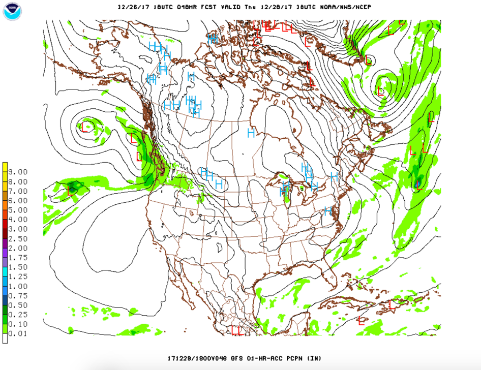
GFS model forecast for Thursday, 12/28/2017. Source: NOAA
The arctic blast of cold air most of us are experiencing will stay for a bit longer. Cold temperatures from the Northern Rockies and eastward will stay into next week. Frigid wind chills and light snowfall will come as well. It will be a chilly New Year’s weekend. Good news for us, as snow won’t be going anywhere.
Lake effect snow will continue for the Great Lakes, including areas of Michigan and New England. The cold arctic air will encourage this.
In the West, some energy on Thursday and into Thursday night will bring precipitation for Idaho and Western Montana. Western Montana should see some snow with the arctic air. The eastern side of the Rockies may be warmer while lower elevations may see some rain in Idaho. The GFS Model shows a surface high over eastern Montana with precipitation westward of the high system.
Stay bundled and enjoy the fresh snow this holiday weekend! Safe sledding!
-Megan
About MaxWeather: We have partnered with the University of North Dakota Dept. of Atmospheric Sciences to give students a practical internship experience, providing weather forecasts for our readers. We will bring you a weekly, student-developed weather update throughout the snowmobiling season.
About the UND program: Located in the heart of cross-country racing territory, the University of North Dakota Dept. of Atmospheric Sciences provides high quality undergraduate and graduate education. Embedded in an environment of significant research and discovery, students have the opportunity to participate in hands-on forecasting and research activities. http://atmos.und.edu/