

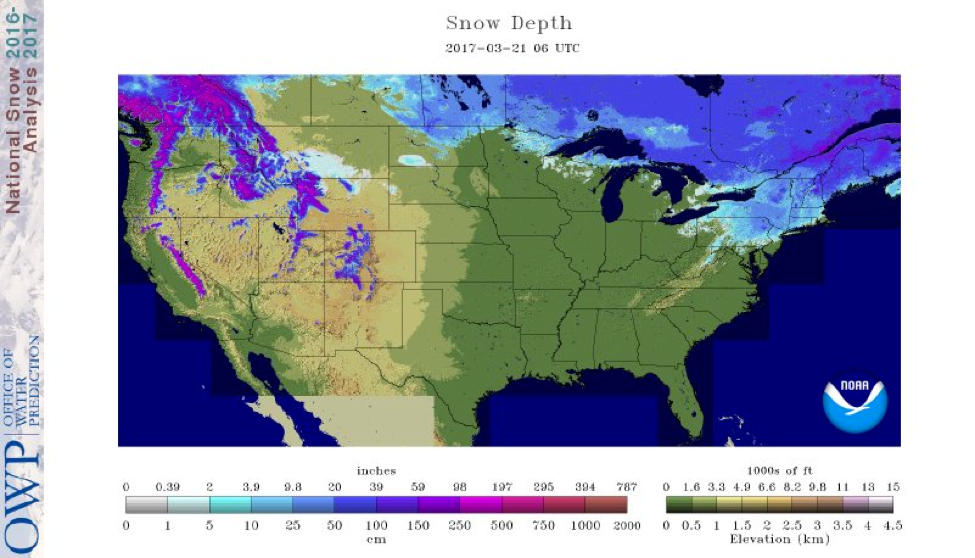
Source: National Operational Hydrologic Remote Sensing Center (NOHRSC)
Here is a final update on modeled snow depth from the NOHRSC. The snow from last week’s Nor’easter is still present over the northeast, with the highest snow totals located over Maine. From the trail reports I’ve read out there, it seems that the snowmobiling is still pretty good. The temperatures have been cooler than average out there, preventing a large snowpack melt. That trend looks to continue over the next few days, with highs in the twenties to mid-thirties. The active winter theme still continues for the west coast’s higher elevations as well as the Rockies, with plenty of snow forecasted over the next seven days. It’s been a fantastic winter for sledding out there.
State Trail Conditions
Maine Trail Conditions | Michigan Trail Conditions | Minnesota Trail Conditions | New Hampshire Trail Conditions | New York Trail Conditions | North Dakota Trail Conditions | Wisconsin Trail Conditions | Vermont Trail Conditions
Though the pattern looks to be pretty wet across much of the United States over the next week or so, little if any snow is expected out of any of these systems, except for the higher elevations out west. Winter held on as long as it could for parts of the country, but left too soon for many others. I’m looking at the long range models and patterns, and I just don’t see anything significant in terms of a large cooling trend that would be needed to have this active pattern mean anything to us snow lovers. Due to this, I haven’t put any model data in for this week, I think any major snow storms won’t show up on the maps until next season.
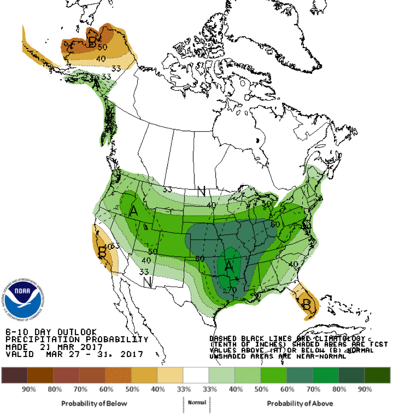
Climate Prediction Center Outlooks (3/21/17)
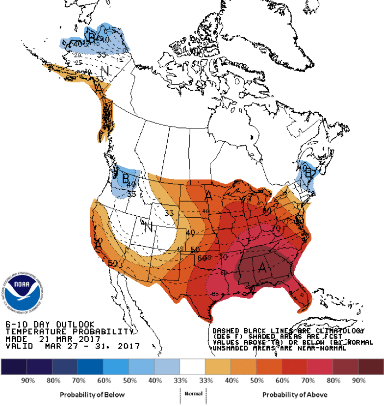
Source: Climate Prediction Center
Here is the CPC’s long range outlook for both temperature and precipitation. As you can see, warm and wet conditions look to persist through most of the continental U.S. Luckily for our friends that still have snow in the northeast and Pacific Northwest, temperatures have a pretty good chance to be below normal over the next 10 days. Keep in mind that average temperatures are around 40°F for these areas this time of year, so below normal doesn’t necessarily mean below freezing. Nonetheless, the snow will surely melt slower than it should for this time of year.
Source: Climate Prediction Center
With winter sadly coming to an unforeseeable end, this will be the last weather post of the season. Thank you for reading these posts over the last month and a half – it’s been an honor to track the snow for people who love snowmobiling so much.
For you folks in the Northeast and Pacific Northwest that still have snow, happy riding!
-Mark
About MaxWeather: We have partnered with the University of North Dakota Dept. of Atmospheric Sciences to give students a practical internship experience, providing weather forecasts for our readers. We will bring you a weekly, student-developed weather update throughout the snowmobiling season. With the spring weather taking hold, we will be on a MaxWeather hiatus until the fall, when we will welcome a new weather intern to the page. Thank you, Mark, for your meterological insights these last six weeks! You’ve done a great job.
About the UND program: Located in the heart of cross-country racing territory, the University of North Dakota Dept. of Atmospheric Sciences provides high quality undergraduate and graduate education. Embedded in an environment of significant research and discovery, students have the opportunity to participate in hands-on forecasting and research activities. http://atmos.und.edu/